Search Posts

Platform:
Date range:
to

3 results for "tag:symbolic-erasure"

Post from Truth Social

Image attachment
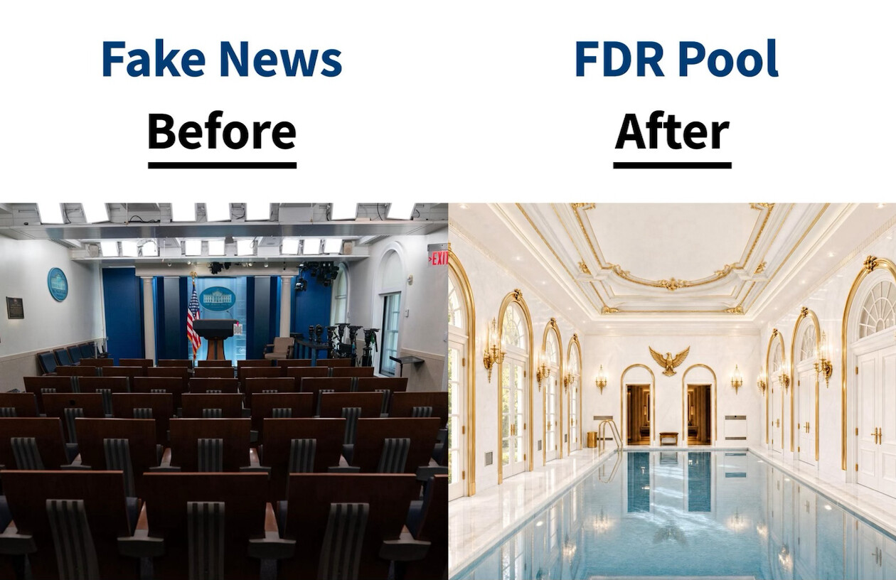
What the image shows meme

A political meme/comparison graphic with two side-by-side photos under headings. The left photo, labeled "Fake News" / "Before," shows the White House press briefing room with rows of empty brown seats facing a blue-curtained podium area with the presidential seal and an American flag. The right photo, labeled "FDR Pool" / "After," shows an ornate, renovated indoor swimming pool room with white and gold-trimmed walls, arched windows and doorways, an eagle emblem on the wall, chandelier-style sconces, and a rectangular pool with light blue water reflecting the ceiling.

Text in image: Fake News Before FDR Pool After

Described automatically. The words above are a machine's reading of the picture, not Trump's.
Post from Truth Social

Image attachment
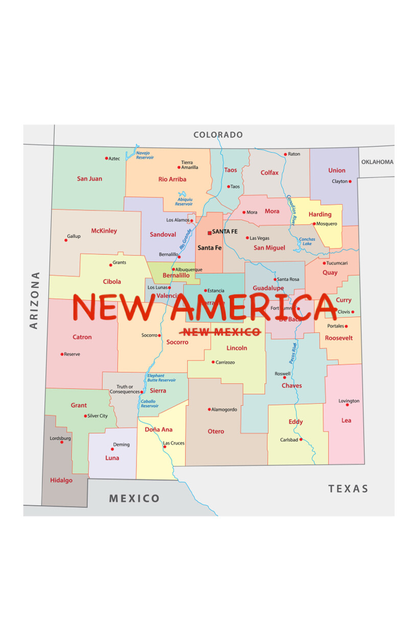
What the image shows document

An edited political-style map of the U.S. state of New Mexico, showing county boundaries in various colors and labeled counties (e.g., San Juan, Rio Arriba, Colfax, Union, Santa Fe, Bernalillo, Socorro, Otero, Eddy, Lea, Hidalgo, etc.), with neighboring states Colorado, Oklahoma, Texas, Arizona, and Mexico labeled around the border. Overlaid in large red text across the map is "NEW AMERICA," with "NEW MEXICO" (the map's original title) struck through with a red line beneath it, implying a renaming of the state.

Text in image: COLORADO OKLAHOMA ARIZONA TEXAS MEXICO San Juan Rio Arriba Taos Colfax Union McKinley Sandoval Mora Harding Gallup Los Alamos SANTA FE Santa Fe Las Vegas San Miguel Clayton Mosquero Bernalillo Cibola Grants Bernalillo Aztec Tierra Amarilla Navajo Reservoir Abiquiu Reservoir Raton Conchas Lake Tucumcari Quay NEW AMERICA NEW MEXICO Valencia Los Lunas Estancia Guadalupe Santa Rosa Curry Clovis Catron Socorro Lincoln De Baca Fort Sumner Portales Roosevelt Reserve Truth or Consequences Elephant Butte Reservoir Sierra Pecos River Roswell Chaves Lovington Grant Silver City Caballo Reservoir Doña Ana Otero Carrizozo Alamogordo Eddy Lea Lordsburg Deming Luna Carlsbad Hidalgo

Described automatically. The words above are a machine's reading of the picture, not Trump's.
Post from Truth Social

Image attachment
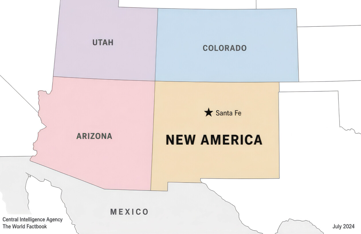
What the image shows chart

A color-coded regional map in the style of a CIA World Factbook map, showing the southwestern United States. Utah is shaded purple, Colorado is shaded blue, Arizona is shaded pink, and the state of New Mexico is shaded tan/orange but relabeled "NEW AMERICA" instead of "New Mexico," with a star marking its capital "Santa Fe." Mexico is shown to the south in gray. Attribution text reads "Central Intelligence Agency / The World Factbook" in the bottom left and a date "July 2024" in the bottom right.

Text in image: UTAH COLORADO ★ Santa Fe ARIZONA NEW AMERICA MEXICO Central Intelligence Agency The World Factbook July 2024

Described automatically. The words above are a machine's reading of the picture, not Trump's.