Search Posts

Platform:
Date range:
to

3 results for "tag:renaming-as-sovereignty"

Post from Truth Social

Image attachment
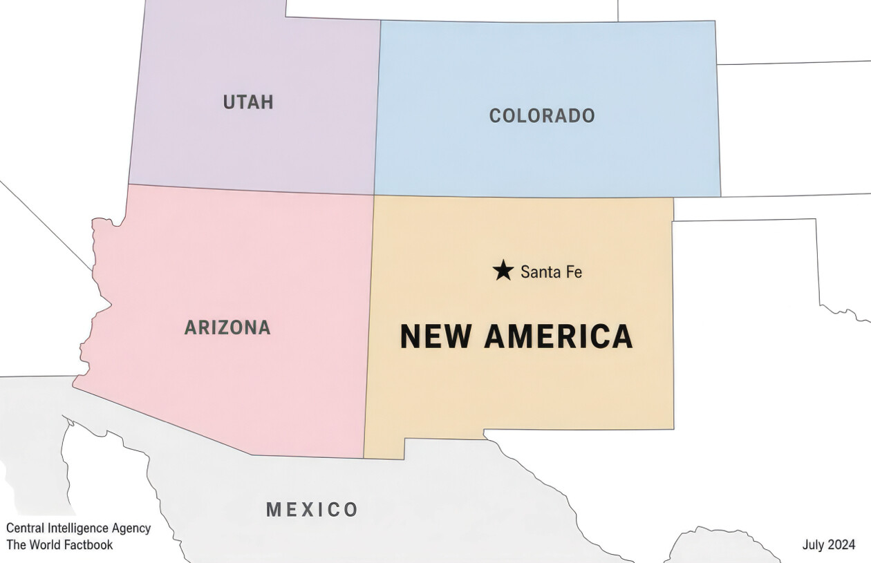
What the image shows chart

A color-coded regional map in the style of a CIA World Factbook map, showing the southwestern United States. Utah is shaded purple, Colorado is shaded blue, Arizona is shaded pink, and the state of New Mexico is shaded tan/orange but relabeled "NEW AMERICA" instead of "New Mexico," with a star marking its capital "Santa Fe." Mexico is shown to the south in gray. Attribution text reads "Central Intelligence Agency / The World Factbook" in the bottom left and a date "July 2024" in the bottom right.

Text in image: UTAH COLORADO ★ Santa Fe ARIZONA NEW AMERICA MEXICO Central Intelligence Agency The World Factbook July 2024

Described automatically. The words above are a machine's reading of the picture, not Trump's.
Listen Visualize
8.3K 1.6K 152

Post from Truth Social

Image attachment
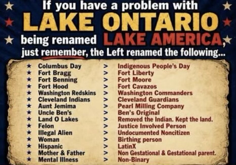
What the image shows meme

A political meme image with a textured dark red/maroon background and small white stars scattered around the border. It presents a two-column comparison list defending the renaming of a lake to "Lake America," framing it as no different from a series of terminology/name changes it attributes to "the Left."

Text in image: If you have a problem with LAKE ONTARIO being renamed LAKE AMERICA, just remember, the Left renamed the following... Columbus Day > Indigenous People's Day Fort Bragg > Fort Liberty Fort Benning > Fort Moore Fort Hood > Fort Cavazos Washington Redskins > Washington Commanders Cleveland Indians > Cleveland Guardians Aunt Jemima > Pearl Milling Company Uncle Ben's > Ben's Original Land O Lakes > Removed the Indian. Kept the land. Felon > Justice Involved Person Illegal Alien > Undocumented Noncitizen Woman > Birthing person Hispanic > LatinX Mother & Father > Non Gestational & Gestational parent Mental Illness > Non-Binary

Described automatically. The words above are a machine's reading of the picture, not Trump's.
Listen Visualize
2.6K 936 132

Post from Truth Social

Image attachment
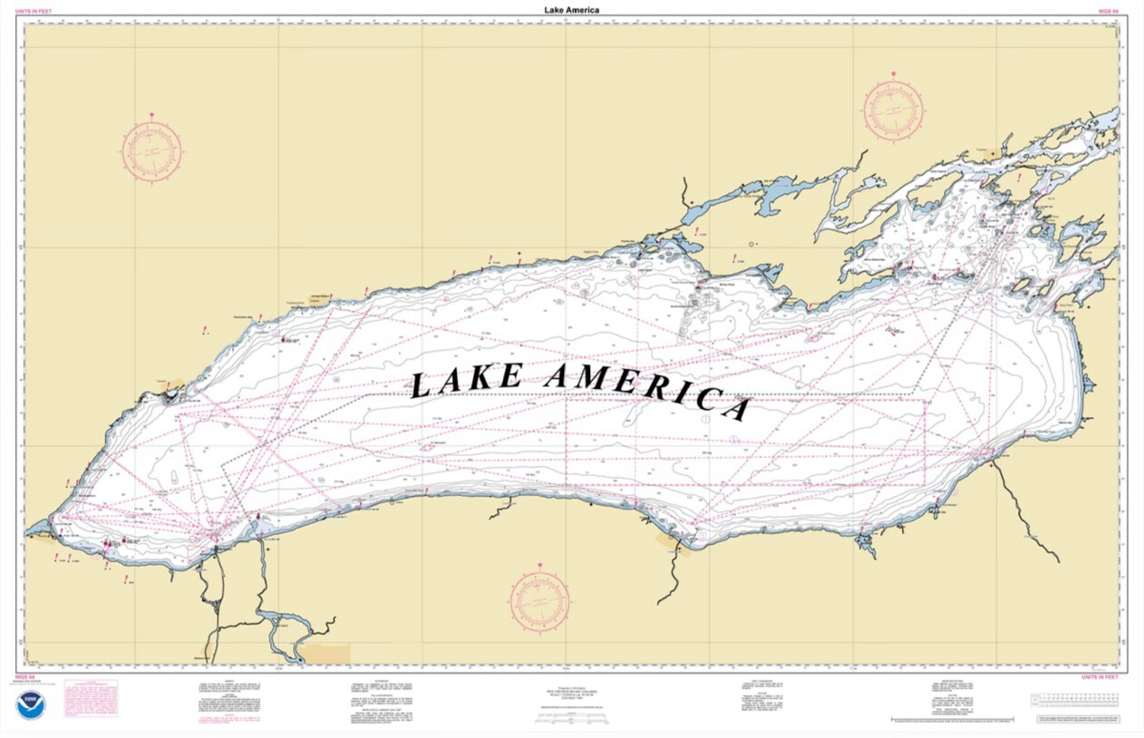
What the image shows chart

This is a mock nautical/navigational chart styled like a NOAA (National Oceanic and Atmospheric Administration) survey map, with the NOAA logo in the bottom-left corner. The chart depicts a large elongated body of water labeled "LAKE AMERICA" in bold italic serif text across its center. The shape of the water body resembles the outline of the Great Lakes region combined together (it has a form similar to a stretched, connected Great Lakes shape) rather than any single real lake. The map includes standard nautical chart elements: depth contour lines, dashed pink/magenta course or survey lines crisscrossing the water, compass rose symbols in several corners, exclamation point hazard markers, small red dots for landmarks, a coordinate grid with tick marks along the borders, and blocks of small disclaimer/legend text along the bottom edge that are too small to read clearly. The land areas are shaded in a tan/beige color, and the water areas are white with gray depth-sounding numbers scattered throughout.

Text in image: Lake America LAKE AMERICA WGS 84 UNITS IN FEET UNITS IN FEET WGS 84

Described automatically. The words above are a machine's reading of the picture, not Trump's.

Listen Visualize
4.6K 1K 261